Showing posts with label Dauphin Island. Show all posts

Tuesday, October 18, 2016

A Visit to the Dauphin Island Area (4)

This post is the final one in a four-part series about our recent trip to Dauphin Island. Our hosts were my sister-in-law Lucy and brother Richard. Son Amos joined us from Baton Rouge. Some comments are below.

Part one is here; part two is here; and part three is here


The area's history of hurricanes is visible in all kinds of ways.


Gulf side beaches are one of the glorious sights on the island.


One of the cannons at Fort Gaines, established on the island in 1821. The fort played a prominent role in the Battle of Mobile Bay in August 1864. 


Sunset from Fort Gaines can be another natural wonder of the island.


Also visible from Dauphin Island are some of the oil rigs in the Gulf. 


Lucy & Richard's house has this drawing that features the Middle Bay Lighthouse. Activated in 1885, the lighthouse was taken out of service in 1967 but still stands in the Bay. The structure is one of five lighthouses that have operated in Alabama. 


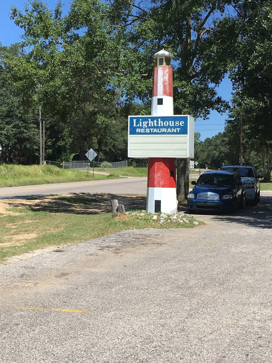
A frequent pleasure of our trips to the Mobile area is a stop for lunch at this establishment at one of the Greenville interstate exits.


Friday, October 14, 2016

A Visit to the Dauphin Island Area (3)

This post is the third of four describing a recent trip Dianne and I made to Dauphin Island to stay with my brother Richard and his wife Lucy. Son Amos joined us from Baton Rouge. Comments are below.

The first post can be found here, the second one here and part four here.


Friday's sunset on the Gulf side of the island was worth a viewing.


On Friday night after Amos arrived from Baton Rouge we headed out in search of some adult beverages. Dianne took this photo.


On Saturday Dianne, Amos and I had a nice lunch at the Pirates Bar & Grill at the Isle Dauphin Club


Built in the late 1950's, the club is one of Dauphin Island's architectural standouts. Son Amos, the urban planner, noted right away that it looked like an example of "googie" architecture. That style of "space age" or "atomic age" building began in southern California in the late 1940's and lasted into the mid-1960's. Many motels, gas stations, coffee shops and other structures were influenced by the style, which was named after a west Hollywood coffee shop called Googies.  


This postcard shows the club in the 1960's.
Source: Troy University Library


There's a very nice view of the water from the club. 


Here's a friend who spent most of the weekend hanging around the house with us. 


The Indian Shell Mound is the oldest sign of man on the island and has survived all the hurricanes. The area is now a small park with a trail, benches and some photographic trees. 


Tuesday, October 11, 2016

A Visit to the Dauphin Island Area (2)

This post is the second of four related to a visit to Dauphin Island Dianne and I made recently. Our son Amos also joined us from Baton Rouge. One of the places we saw with our hosts, my brother Richard and his wife Lucy, was the small community of Coden

This unincorporated fishing village is located on Bayou Coden, and the name is an English version of the French Coq d'Inde. Like nearby Bayou la Batre, Coden was a resort town in the late 19th century, but the 1906 hurricane ended much of that business. I've included comments below my photos and a few historical photos at the end of this post.  

The first post in the series can be found here, part three here and part four here.


Coden has a community center and a post office, both good signs of survival in a small town. 


Always sad to see abandoned structures, but churches seem especially so. The sign says "Coleman Chapel A.M.E. Zion Church, Pastor B. Sanders". I spent some time searching on Google and could find nothing about this church. 


Abandoned boats are a common sight in this part of Alabama. 


Now here are a couple of interesting sights down an unpaved road near Coden. We were looking for Zirlotts Seafood operation, a legendary family business in the area. We found it, and even though we arrived after closing time that afternoon, family members came out of their house to open up and let us purchase some of the goods. 

As we left, we decided to take a closer look at these two items which we had spotted earlier. The trailer above is behind the fence of a small cattle farm. The structure below mystified all of us, but someone else has suggested to me that it looks like a hunting blind. 


A house in Coden with a facade covered with oyster shells, about 1905.

Source: Alabama Mosaic


A grocery store in Coden before 1905

Source: Alabama Mosaic 


Rolston Hotel in Coden, ca. 1916

Source: Alabama Mosaic


Friday, October 7, 2016

A Visit to the Dauphin Island Area (1)

OK, just what is this "Dauphin" thing, anyway? 

From 1350 to 1791 and 1824 to 1830 this term described the heir apparent to the throne of France. The family's coat of arms featured a dolphin, which in French is "dauphin". That's a very simplified version of the French royal history; you can read a much more detailed version on Wikipedia

Over the years Dauphin Island has been occupied by Native American, Spanish, French, British, American and Confederate populations. The island has a long, fascinating history that began more than 500 years ago with frequent Native American visits. Spanish mapped the island around 1519 and named it Isla de San Feliz. The French, who arrived in the late 17th century, called it Ile du Massacre since they found dozens of skeletons there. U.S. forces seized the island from Spain in 1813, and the British held it briefly in 1815. Dauphin Island became part of the Alabama Territory upon its creation in 1817.

Today the island is mostly a vacation haven and target for hurricanes. Since 1979 Frederick, Elena, Danny, Georges, Ivan and Katrina have all done serious damage on the island. 

Sometime years ago when the kids were young, and we were visiting Gulf Shores, Dianne, the kids and I took the ferry from Fort Morgan and spent some time on the island. Recently my brother Richard and his wife Lucy have bought an interest in a house on the island and invited Dianne and I to come visit. Our son Amos joined us from Baton Rouge. This post and three that follow cover some of the sights from that long weekend. 

I've included two historical photos and a map at the end.

Part two of this series is here, part three here and part four here.


Here's the first sunset from the deck of their house on Lafitte Bay. 


Here's the view bright and early next morning. 


We had an excellent lunch at this popular place back on the mainland. The restaurant is located in Irvington just past Bayou La Batre.  


Today Bayou La Batre is primarily a fishing town. Its origins go back to a 1786 land grant from the Spanish to a French settler. In 1811 the town became part of the United States, and by the 1830's had its own hotel. Because of its location on the water, tourism developed after the Civil War. 


A hurricane in 1906 devastated the town and its tourism. By the 1920's the seafood industry and later shipbuilding became the economic mainstays. In the late 1970's immigrants from Vietnam, Cambodia and Laos added significantly to the local cultural mix. An episode of the Alabama Public Television program Journey Proud explores these changes over the recent decades.


Abandoned structures and boats are frequent sights in the Bayou La Batre area. 


Smee General Merchandise in Bayou La Batre ca. 1900

Source: Alabama Mosaic


Fishing boats and oyster cannery in Bayou La Batre in the 1930's


Source: Alabama Mosaic

Fire insurance map of Bayou La Batre, 1955

Source: Alabama Mosaic