Showing posts with label map. Show all posts

Friday, February 2, 2024

Alabama Official Highway Maps 2023-2024

I've done a number of posts on this blog about various maps, usually related to Alabama, Shelby County or Pelham. One of these days I hope to do a piece linking all those items together. In the meantime, here's another one...

This post is the fourth featuring those "Official Highway Maps" of the state you can get for free from the state travel website or pick up at welcome centers or rest stops. I love these maps with their colorful covers; and when you open them up, you have a huge detailed map of the state. 

In the first entry in this series I covered maps from 1976 until 2009-10. Images included the Space and Rocket Center, Barber Motorsports Museum, a statue in Tuskegee, bike riders, the state coat of arms, a beach or two and much more. Images in the second post covered the Gorgas House in Tuscaloosa, Sturdivant Hall in Selma, the Alabama Shakespeare Festival, Birmingham Museum of Art, a different Space and Rocket Center photo, Birmingham Museum of Art, and others, including beaches. The dates in that post ranged from 2004 to 2021-22. Just for fun I also included a 1974 state map from Texaco and a railroad map issued by the state.

In the early days the back cover might include examples of road signs or in at least one case just "HELP" which could be put on your dashboard. However, most back covers feature the governor at the time and that practice continues today. The third post focused on a 1973 map I came across, with George Wallace on the back. I'm not sure when the state started creating these particular kinds of maps.

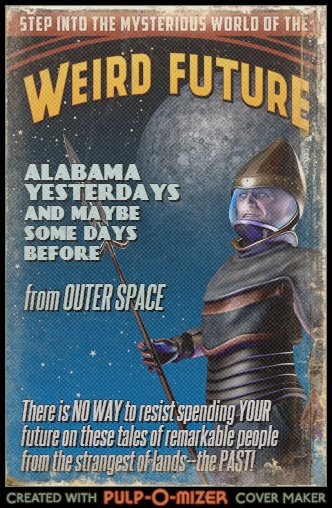
So now we come to the latest highway map covers, and here they are....


Thursday, June 1, 2023

Pondering Alabama Maps (10): A Neat One from 1906

I've written quite a few posts on this blog related to maps. I've done a series "Pondering Alabama Maps" with nine entries including Pelham in 1917, 1926 and 1928; early state road maps; an 1867 railroad map, a 1913 highway proposal, and Shelby County in 1822 and 1825. I've also covered more recent state highway maps and Benton County in 1852.

So here we are again, pondering an Alabama map. As with so many things, I stumbled across this one on the Alabama Mosaic site. The map was published in 1906 by the Geographical Publishing Company of Chicago, which existed from around 1893 until 1966. Perhaps the Birmingham News was one of several clients for which the company produced similar maps. 

The map notes that the News is "Alabama's Greatest Newspaper" and has the "Largest Circulation of Alabama Newspapers." The annual subscription cost for delivery on a rural route was $3.40; by mail $5.00. I presume most sales at this time were on newsstands and from young boys hawking each day's issue on the sidewalks. 

Shown on the map are the governors of Alabama and the state capitol building in Montgomery. The map copyright is 1906, but oddly Governor B.B. Comer is included; he served 1907 until 1911. His election took place in 1906, however. 

Each county on the map includes numerous towns and cities. Naturally when I look at old state maps I look for Pelham and it's on this one, right there between Helena and Keystone. Although its growth did not begin until the 1970s, Pelham has been around since the 1870s.

If you look at this map on the Mosaic web site, you can zoom in for closer examination.


Thursday, April 15, 2021

Benton County in 1852

Alabama has had several county names that are no longer in use, and Benton is one of them. Let's investigate.

On December 18, 1832, the state legislature created Benton County. The Encyclopedia of Alabama entry notes, "The county was initially named Benton County in honor of Missouri senator Thomas Hart Benton, an arch defender of westward expansion and slavery. After Benton declared himself an opponent of slavery in the 1850s, Alabama supporters of slavery voted to change the county's name to Calhoun in honor of radical secessionist John C. Calhoun."

Benton was an important figure in antebellum American history. He served in the U.S. Senate from 1821 until 1851. During that time he supported what became known as "Manifest Destiny", the idea that the United States should expand all the way to the Pacific Ocean. He supported slavery and owned slaves himself, but after the Mexican-American War he began to oppose it and the domination of slave interests in the nation's political life. After he rejected the Compromise of 1850 as favoring slavery interests, the Missouri legislature refused to re-elect him to the Senate. He did serve a term in the U.S. House before his death in 1858.

Benton had practiced law in Tennessee beginning in 1805, and served a term in the state senate. Andrew Jackson noticed him and appointed him lieutenant colonel and aide to represent him in Washington during the War of 1812 Benton wanted to see action, and the two ended up brawling in 1813; Jackson was wounded. In 1815 Benton moved to the new Missouri Territory. 

Benton, a town on the Alabama River in Lowndes County is also named after Thomas Hart Benton to honor his efforts in the Creek War. His later apostasy on slavery did not trigger a name change. A post office was established there in 1833, and the town incorporated in 1964. Bill Traylor, the famed African-American self taught artist was born in the town around 1853; he died in 1949. 

The map below of Benton County in 1852 was created by Jerry A. Daniel in 1975. The name was changed on January 29, 1858, a few months before Benton died on April 10. 


Created in 1975 by Jerry A. Daniel

Source: Jacksonville State University Digital Commons


Thomas Hart Benton [1782-1858] 

Photograph taken by Mathew Brady sometime between 1844 and 1858. Brady later became famous for his Civil War photos. 

Source: Wikipedia


Tuesday, April 3, 2018

Pondering Alabama Maps (8): Shelby County in 1822 and 1825

I've written in a previous blog post "Once Shelbyville, A.T., Now Pelham" about the city's early history as the Shelby County seat. That lasted from 1817 in the Alabama Territory period until 1826, when Columbiana became the county seat. Pelham changed its name to honor Major John Pelham sometime in the 1870's.

Below the photo of the historical marker describing all this you'll find two maps of the county from 1822 and 1825. These snapshots were taken from two maps of Alabama created when the area was still in its first decade after becaming a territory and then a state. Despite this early era, the population of the county was more than 2400 in 1820 and over 5700 by 1830.

The 1822 state map was created by Fielding Lucas, Jr.[1781-1854], a successful cartographer and map publisher in Baltimore in the early 19th century. Lucas was the primary engraver on A Complete Historical, Chronological and Geographical American Atlas published by the firm of Carey & Lea in Philadelphia in 1822. This atlas was the most detailed and important one of the United States at the time of publication. A copy of that first edition is currently for sale at $14, 000, which gives some idea of its importance in the mapping history of the United States. The atlas also included extensive historical background on states, cities, etc. 

The 1825 version of Shelby County's map appeared in a German edition of the Carey and Lea atlas. The work was completely re-engraved under military and commercial cartographer Carl Ferdinand Weiland [1782-1847]. The Shelby County map is a very good copy of Lucas' but slight differences can be found. Compare the western borders of the county on each map, for instance. 

Some other blog posts about Pelham on other historical maps can be found here. You can read more about the only other county town on these maps, Wilsonville, here


This 1822 view of Shelby County is taken from a state map by Fielding Lucas, Jr., and published by Carey and Lea of Philadelphia.

Source: Historical Maps of Alabama


This view of Shelby County appeared in the 1825 German edition of Carey & Lea's atlas.


Tuesday, September 19, 2017

Montevallo is Missing! [My 350th blog post!]

Well, sort of. And only on a map. Sort of....let's investigate.

On September 9th, the city of Montevallo had a festival to celebrate it's bicentennial. Like Pelham, once known as Shelbyville and Shelby County's original seat of government, Montevallo predates Alabama statehood in 1819. 

The first white settler in the county, Jess Wilson, arrived in 1814 and others followed as the Indian threat diminshed. The area became "Wilson's Hill" by 1822 and Montevallo in 1826 according to Clark Hultquist and Carey Heatherly's Montevallo [Arcadia Images of America series, 2011, p. 11]. You can read some more early history here. Montevallo was incorporated by the state legislature in 1848 when almost 1000 people lived there. 

Columbia in the southern part of the county became the seat in 1826 and a post office was established. The town became Columbiana in 1832 and incorporated in 1837.

I was perusing some old Alabama maps recently and noticed something interesting related to this early history. Excerpts are below; all map portions are taken from the state maps at the University of Alabama's Historical Map Archive. You'll note some mysteries as you look at these maps and read my comments. Montevallo appears on a map as early as 1823, then an 1824 map lists "Wilson Hill" but no "Montevallo". 

These maps from the 1820's and 1830's vary in the towns shown. Making maps in those days was hardly a standardized business. Did mapmakers in Philadelphia or Baltimore actually visit these places or copy from previous maps or what?

Feel free to leave insights in the comments section!


On John Melish's 1818 map of Alabama, we see Shelby County in its earliest form. The county was created by the legislature of the Alabama Territory in February 1818. The only named locations in Shelby at this time were Fort Strother and Fort Villanos, Camp Wills and Camp Bradley and Littafuchee. All but Fort Villanos would become part of St. Clair County when it was created in November.

Fort Strother was constructed during the Creek War by several thousand of Andrew Jackson's Tennessee Militia  just before the Battle of Talladega on November 8, 1813. Presumably the other fort and camps were also a part of that war. Littafuchee was an Upper Creek town; the name means "making of arrows." In October 1813 some of the Militia captured the town 


Portion of Fielding Lucas' 1822 map of Alabama that shows two towns in Shelby County at that time. A post office was established at the current Wilsonville in the same year; the town wasn't incorporated until 1897. But this map shows a weirdly shaped Shelby County; is this Wilsonville supposed to be Wilson's Hill? Montevallo is in southern Shelby County, after all, and today's Wilsonville is in the eastern part near the Coosa River.


On this section of Henry S. Tanner's 1823 state map, we find Shelbyville and Montevallo as well as Kelley's Village in the northeastern corner of the county.


Anthony Finley's 1824 state map lists only Shelbyville and Wilson Hill. What happened to "Montevallo"?


Henry S. Tanner's 1825 map again lists not only Shelbyville and Montevallo, but  also Kelley's Village. That third place is a mystery; it doesn't appear in Virginia Foscue's Place Names in Alabama [University of Alabama Press, 1989]. However, there are a Kelley Mountain and Kelley Creek in Shelby County.


Taken from David Burr's 1836 map of Alabama. Notice there are still only two towns noted in Shelby County, Shelbyville and now Montevallo. Poor Columbiana, the country seat, is getting no recognition here. 


Friday, June 2, 2017

Alabama Highway Map Cover from 1973

I've done a lot of map posts on this blog, and there's a reason for that--I love maps! Back in March I did a couple of posts on "Some Alabama Highway Map Covers" using mostly official maps from the state highway department in my collection. Those are the free maps you can pick up at state welcome centers and rest stops. 

The oldest one in my collection was an example from 1976. Recently I explored a consignment shop here in Pelham and came across this one from 1973. I thought I'd post it here.

The map has a theme of "Alabama Has It All", something Governor George Wallace explains in his message on the back cover. There's also a quaint template for a stamp and address; I guess the highway and tourist departments would mail them on request and not have to use an envelope.

I wonder when the earliest of these maps was issued. If you know, leave that information in the comments!

This map was modestly priced, but I didn't buy it. Can't collect everything, you know. 


Friday, March 17, 2017

Some Alabama Highway Map Covers (2)

In part one of this blog post, I discussed some of the "official" highway maps of Alabama that I've collected over the years as well as a few published by the Rand McNally company. I also included a brief look at the history of road and highway maps in general. Here's another selection of mostly official ones; some comments below.

I should probably note some covers on these state maps that I'd like to see in the future. How about one featuring a collage of the state's famous writers--Harper Lee, Rick Bragg, Fannie Flagg, Robert McCammon, and so many more? Or a collage of the state's film and TV stars--Jim Nabors, Kate Jackson, Courtney Cox, Henry Walthall, Cathy O'Donnell, and that young whippersnapper from Cullman whose name escapes me? Oh, right, Channing Tatum. Or maybe Helen Keller, perhaps the single most famous individual from Alabama?

Ah, well, I guess those sorts of covers might not attract the tourists like yet another one featuring the beach!


Here we have two typical map covers--an historic site and a site of natural beauty.


One more beach cover, and another historic site. Looking over all these maps I've collected, I'm pleased to see how many have featured historic places.


At some point the back cover of these maps transitioned from photos and statements from the governor and the state highway director to a photo of the governor and his wife along with a statement. Someone seems to be missing from that map on the right, however.


OK, ok, another beach cover. But this one's pretty cute, and those beaches do bring in a lot of dollars.


Wait--they have a Shakespeare festival in Alabama? I think this may be the only one I've collected that features the performing arts. Perhaps the Alabama Ballet is due for a cover? The Alabama Symphony Orchestra

I'm really surprised none of the country music acts or American idol winners from Alabama have appeared on a map cover. 


This one is the second map cover to feature the Space and Rocket Center in Huntsville. Our kids Amos and Becca both did a week at Space Camp and enjoyed it. 


Beach map covers always show the blue water and white sands--where are the jellyfish? Sharks? Sand burrs? Or maybe just a dune or two?


Wait--they have museums in Alabama? 

This one is certainly worth a visit, as we've done periodically over the years. Son Amos and daughter Becca always enjoyed a tour, especially when it started with one of those wonderful Sunday jazz brunches! 

Oh, and the Alabama Museums Association has a long list of members. Maybe another one will be featured on an official highway map in our lifetime.


And finally a Rand McNally map and one of those free gas station maps from back in the day. Dad dated this one for us.


UPDATE 1 February 2019

I wanted to add the newer highway maps for 2017-18 and also a specialized map from 2001.


Update 20 August 2019: And here's the 2019-2020 official state highway map:


This one has the same "icons" featured on the back cover.


Friday, March 10, 2017

Some Alabama Highway Map Covers (1)


An interest in maps seems to run in our family; dad was the one who started it all. Over the years I've collected a number of Alabama highway maps, including the "official" ones issued each year by the state government and available in rest stops along the interstates and welcome stations at the state line. In this post I'm exploring some of these maps. Their front and back covers can tell us some interesting things; let's investigate.

Highway maps began to appear in the United States around World War I as private and military traffic increased. Rand McNally issued its first highway map in 1917. Alabama issued a road map as early as 1914. However, many of those roads were probably impassable by motorized vehicles! I've done a blog post on early Alabama road maps here.

By the 1950's states and map and gas companies were issuing what we think of as highway maps. I used to enjoy getting these [they were free then] on trips as we stopped at Texaco and other stations. AAA has a good history of these maps on its web site. 

I'm not sure when Alabama began issuing what we find at today's rest stops as "official" highway maps. The earliest in my collection is 1976. Many of these maps are shown below; I've left comments on some. You can find a second selection of these maps here. The Alabama Department of Transportation issues these maps "for free distribution only."


This map features the U.S. Bicentennial, a series of celebrations in the 1970's to honor the creation of America as an independent nation. The festivities culminated on July 4, 1976, the 200th anniversary of the Declaration of Independence. 


For Alabama, and compared to all the subsequent "official" highway map covers, this one is pretty psychedelic


Maps in this period seem to feature the Governor and the state highway director. 


I could make a joke here about the relationship of this back cover to the administration of Fob James, but I'll restrain myself.


Here's at least the second map on which the Alabama Coat of Arms has appeared. The shield features symbols of five nations that have been sovereign over some part or all of what is now Alabama: France, Spain, United Kingdom, Confederacy and the United States. 


Now we have a cover that sets the stage for many to follow by featuring an iconic Alabama landmark. 


I suppose since they are responsible for these maps the State Highway Department deserves to have its building on one of them.


The "Alabama Reunion" was a year-long celebration of state history and culture and the 170th anniversary of statehood.


Well, I guess highway map covers can feature highways and bridges, too.


And now for a pretty country road....


Wait--Alabama has beaches? This theme will reappear....


Here the state is promoting the Robert Trent Jones Golf Trail which opened in 1992 and some natural beauty. 


These two covers highlight more natural beauty and outdoor activities.


This cover acknowledges the important role of Booker T. Washington and Tuskegee Institute/University in state and national history. It's also a rare cover featuring any kind of history.


Wait--they do stuff indoors in Alabama? Barber Vintage Motorsports Museum is a great institution to highlight--if you haven't been, it's worth a visit.


OK, back to the beach...


One of the state's most-visited sites finally makes a highway map cover.


And finally three state highway maps from Rand McNally. I could not find a date on this one, but it's probably from the 1970's.


No date on map; Amazon listing has 1984


1997