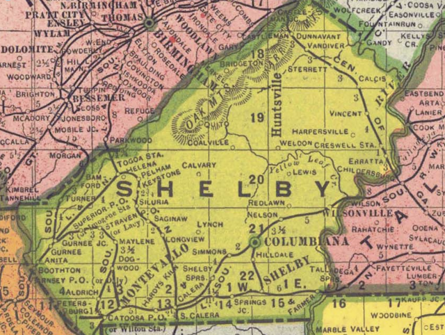
I've written quite a few posts on this blog related to maps. I've done a series "Pondering Alabama Maps" with nine entries including Pelham in 1917, 1926 and 1928; early state road maps; an 1867 railroad map, a 1913 highway proposal, and Shelby County in 1822 and 1825. I've also covered more recent state highway maps and Benton County in 1852.
So here we are again, pondering an Alabama map. As with so many things, I stumbled across this one on the Alabama Mosaic site. The map was published in 1906 by the Geographical Publishing Company of Chicago, which existed from around 1893 until 1966. Perhaps the Birmingham News was one of several clients for which the company produced similar maps.
The map notes that the News is "Alabama's Greatest Newspaper" and has the "Largest Circulation of Alabama Newspapers." The annual subscription cost for delivery on a rural route was $3.40; by mail $5.00. I presume most sales at this time were on newsstands and from young boys hawking each day's issue on the sidewalks.
Shown on the map are the governors of Alabama and the state capitol building in Montgomery. The map copyright is 1906, but oddly Governor B.B. Comer is included; he served 1907 until 1911. His election took place in 1906, however.
Each county on the map includes numerous towns and cities. Naturally when I look at old state maps I look for Pelham and it's on this one, right there between Helena and Keystone. Although its growth did not begin until the 1970s, Pelham has been around since the 1870s.
If you look at this map on the Mosaic web site, you can zoom in for closer examination.


No comments:
Post a Comment