An interest in maps seems to run in our family; dad was the one who started it all. Over the years I've collected a number of Alabama highway maps, including the "official" ones issued each year by the state government and available in rest stops along the interstates and welcome stations at the state line. In this post I'm exploring some of these maps. Their front and back covers can tell us some interesting things; let's investigate.
Highway maps began to appear in the United States around World War I as private and military traffic increased. Rand McNally issued its first highway map in 1917. Alabama issued a road map as early as 1914. However, many of those roads were probably impassable by motorized vehicles! I've done a blog post on early Alabama road maps here.
By the 1950's states and map and gas companies were issuing what we think of as highway maps. I used to enjoy getting these [they were free then] on trips as we stopped at Texaco and other stations. AAA has a good history of these maps on its web site.
I'm not sure when Alabama began issuing what we find at today's rest stops as "official" highway maps. The earliest in my collection is 1976. Many of these maps are shown below; I've left comments on some. You can find a second selection of these maps here. The Alabama Department of Transportation issues these maps "for free distribution only."
This map features the U.S. Bicentennial, a series of celebrations in the 1970's to honor the creation of America as an independent nation. The festivities culminated on July 4, 1976, the 200th anniversary of the Declaration of Independence.
For Alabama, and compared to all the subsequent "official" highway map covers, this one is pretty psychedelic.
Maps in this period seem to feature the Governor and the state highway director.
I could make a joke here about the relationship of this back cover to the administration of Fob James, but I'll restrain myself.
Here's at least the second map on which the Alabama Coat of Arms has appeared. The shield features symbols of five nations that have been sovereign over some part or all of what is now Alabama: France, Spain, United Kingdom, Confederacy and the United States.
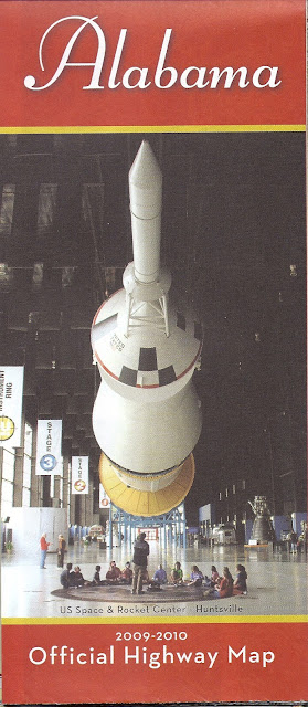
Now we have a cover that sets the stage for many to follow by featuring an iconic Alabama landmark.
I suppose since they are responsible for these maps the State Highway Department deserves to have its building on one of them.
The "Alabama Reunion" was a year-long celebration of state history and culture and the 170th anniversary of statehood.
Well, I guess highway map covers can feature highways and bridges, too.
And now for a pretty country road....
Wait--Alabama has beaches? This theme will reappear....
Here the state is promoting the Robert Trent Jones Golf Trail which opened in 1992 and some natural beauty.
These two covers highlight more natural beauty and outdoor activities.
This cover acknowledges the important role of Booker T. Washington and Tuskegee Institute/University in state and national history. It's also a rare cover featuring any kind of history.
Wait--they do stuff indoors in Alabama? Barber Vintage Motorsports Museum is a great institution to highlight--if you haven't been, it's worth a visit.
OK, back to the beach...
One of the state's most-visited sites finally makes a highway map cover.
And finally three state highway maps from Rand McNally. I could not find a date on this one, but it's probably from the 1970's.
No date on map; Amazon listing has 1984
1997


No comments:
Post a Comment