Showing posts sorted by date for query maps. Sort by relevance Show all posts

Friday, February 2, 2024

Alabama Official Highway Maps 2023-2024

I've done a number of posts on this blog about various maps, usually related to Alabama, Shelby County or Pelham. One of these days I hope to do a piece linking all those items together. In the meantime, here's another one...

This post is the fourth featuring those "Official Highway Maps" of the state you can get for free from the state travel website or pick up at welcome centers or rest stops. I love these maps with their colorful covers; and when you open them up, you have a huge detailed map of the state. 

In the first entry in this series I covered maps from 1976 until 2009-10. Images included the Space and Rocket Center, Barber Motorsports Museum, a statue in Tuskegee, bike riders, the state coat of arms, a beach or two and much more. Images in the second post covered the Gorgas House in Tuscaloosa, Sturdivant Hall in Selma, the Alabama Shakespeare Festival, Birmingham Museum of Art, a different Space and Rocket Center photo, Birmingham Museum of Art, and others, including beaches. The dates in that post ranged from 2004 to 2021-22. Just for fun I also included a 1974 state map from Texaco and a railroad map issued by the state.

In the early days the back cover might include examples of road signs or in at least one case just "HELP" which could be put on your dashboard. However, most back covers feature the governor at the time and that practice continues today. The third post focused on a 1973 map I came across, with George Wallace on the back. I'm not sure when the state started creating these particular kinds of maps.

So now we come to the latest highway map covers, and here they are....


Friday, July 7, 2023

Dead Towns of Alabama: Oxanna

There once was a place called Oxanna...perhaps a town on the yellow brick road to Oz? Let's investigate.


I've written before about Falco, a pretty much dead town in south Alabama just above the Florida line in Covington County. That town rose and fell with the timber industry; Oxanna's story is a bit different. 

In 1872 the Woodstock Iron Company was formed by Samuel Noble, Daniel Tyler,, and their families to build a furnace that would produce quality charcoal pig iron in Calhoun County. The company developed the private community of Anniston to support this effort; only workers, their families and other relevant individuals could live there. By 1880 the town had a population of 942.

In the spring of 1883 the Georgia Pacific Railroad being built from Atlanta to Birmingham reached Anniston. The town abandoned its exclusivity, and Woodstock planned to sell lots to anyone. Railroad developers John B. Gordon, his brother and others formed the Southern Development, Land and Immigration Company to purchase a small valley between Anniston and Oxford. They began development of "Central City" which was soon renamed Oxanna. 

The new town was expected to have areas for business, manufacturing and residences, sidewalks, and a first class hotel. The Oxanna Tribune newspaper began publication in September 1883. The Oxanna Hotel thrived for a period until the much fancier Anniston Inn opened in spring 1885. In 1886 the town incorporated and elected a mayor and council. 

By 1900 Oxanna had reached a population of 1184; Oxford had 1372 people and Anniston had boomed to 9695. Oxanna had soldiered on, but in the following year a successful petition from Anniston citizens to the legislature resulted in annexation of the smaller town. 

Wikipedia has a list of Alabama ghost towns, but neither Falco nor Oxanna are on it. The two also do not appear in W. Stuart Harris' Dead Towns of Alabama, first published in 1977.

I wrote a blog post in 2018 "Whatever Happened to Powhatan and Praco?" that examined the fates of those now-dead Jefferson County mining towns. My mother was born in Powhatan; one of her sisters, my aunt Marjorie, was born in Praco. I've also done "Whatever Happened to Advance, Alabama?"  I plan to examine more disappeared Alabama towns in the future. 

Newspaper articles below were found via the Library of Congress' Chronicling America database. 


Further Reading

Grace Hooten Gates has written extensively on the early history of Anniston and provides some information on Oxanna in her works. Her book The Model City of the New South: Anniston, Alabama, 1872-1900 was published in 1978. Her article "Anniston: Model City and Rival City" appeared in the Alabama Review in January 1978. That article has a good account of the rivalry between Anniston and Oxanna. Another of her articles, "Anniston: Transition from Company Town to Public Town" was published in the January 1984 issue of the Alabama Review. 


Savannah Morning News 15 October 1883 


Birmingham Age-Herald 11 January 1901


During it's short life, Oxanna had its share of troubles:


Birmingham Age-Herald 29 September 1899


Birmingham Age-Herald 8 September 1900


From George F. Cram's 1904 Alabama map, which shows Oxanna as a separate town. 

Source: University of Alabama Historical Maps


And now for something completely random....


Sacramento Daily Record-Union 20 Nov 1890


Source: ebay

Bradycrotine, the Southern Woman's Headache Cure, was made in Macon GA by Dr. Welch.


Thursday, June 1, 2023

Pondering Alabama Maps (10): A Neat One from 1906

I've written quite a few posts on this blog related to maps. I've done a series "Pondering Alabama Maps" with nine entries including Pelham in 1917, 1926 and 1928; early state road maps; an 1867 railroad map, a 1913 highway proposal, and Shelby County in 1822 and 1825. I've also covered more recent state highway maps and Benton County in 1852.

So here we are again, pondering an Alabama map. As with so many things, I stumbled across this one on the Alabama Mosaic site. The map was published in 1906 by the Geographical Publishing Company of Chicago, which existed from around 1893 until 1966. Perhaps the Birmingham News was one of several clients for which the company produced similar maps. 

The map notes that the News is "Alabama's Greatest Newspaper" and has the "Largest Circulation of Alabama Newspapers." The annual subscription cost for delivery on a rural route was $3.40; by mail $5.00. I presume most sales at this time were on newsstands and from young boys hawking each day's issue on the sidewalks. 

Shown on the map are the governors of Alabama and the state capitol building in Montgomery. The map copyright is 1906, but oddly Governor B.B. Comer is included; he served 1907 until 1911. His election took place in 1906, however. 

Each county on the map includes numerous towns and cities. Naturally when I look at old state maps I look for Pelham and it's on this one, right there between Helena and Keystone. Although its growth did not begin until the 1970s, Pelham has been around since the 1870s.

If you look at this map on the Mosaic web site, you can zoom in for closer examination.


Thursday, May 11, 2023

Alabama Slaves Auctioned in New Orleans in 1858

The digital collections of the Smithsonian Institution are a rich source of Alabama-related materials. In a recent wandering there I came across the item below.


That item is a broadside advertising a slave auction in New Orleans on March 25, 1858. As noted, the auction took place in the rotunda of the St. Louis Hotel, built in 1838 at the corner of St. Louis and Chartres Street. Such auctions were common there before the Civil War. The hotel, rebuilt in 1960, continues to operate as the Omni Royal Orleans.

Of course, one thing about this broadside really caught my attention. Thirteen slaves were to be auctioned, eight were from Alabama and the others being "acclimated slaves". His wife Martha and their four children were included with George, so there are actually thirteen from the state:


Absalom, 28, plantation hand
Ned, 43, plantation hand
Tom, about 46, plantation hand
Bill, 23, plantation hand
Frank, 25, plantation hand
Alfred, 35, plantation hand
Polly, 23, cook, washer and ironer
George, 23, plantation hand and carriage driver; to be sold with his wife Martha, 30 and their four children, Ned, 7, Nancy 6, Horace, 4, and Mary, 1

The broadside gives more details about the eight that might be of interest to the buyer or in the interest of full disclosure by the seller. 
One question immediately arises: why weren't these slaves auctioned in Montgomery, which had a large slave market for many years? A slave market also operated in Mobile. Perhaps transport of the slaves to one of the New Orleans markets would bring higher prices. Also unknown is whether these slaves came from the same Alabama plantation. 
I did manage to find some information on the slave auctioneer, "N. Vignie". The Louisiana Statewide Death Index gives Norbert Vignie's birth year as 1811 and death date as April 29, 1877, in New Orleans. The 1850 U.S. Census notes his occupation as auctioneer in the "Miscellaneous Business Services" industry. 
Vignie's office is given on the broadside as No. 8 Banks' Arcade Passage; the Arcade was a block-long structure built in 1833 by Thomas Banks. The building is now the St. James Hotel. He also lists the corner of Conti Street and Exchange Alley, the site of numerous office and retail establishments over the years. Presumably he had two offices, which might mean he was very active in the slave trade auctions in the city. 
In 1870 the U.S. Census listed him as living in Ward 6 of New Orleans, perhaps at the 293 Royal Street that appeared in the 1875 city directory. His occupation? "Retired auctioneer."
Too bad we can't follow the life stories of the slaves beyond this broadside. 


Source: Collection of the Smithsonian National Museum of African American History and Culture


St. Louis Hotel 

Source: Wikipedia


Google maps shows this building at 293 Royal Street in New Orleans, near the Hotel Monteleone, and perhaps Vignie's last address.


Friday, January 13, 2023

Snowy Terror on Alabama 36

On December 26 this past year Dianne, our son Amos and myself were headed from Pelham to Huntsville. I had read about the chance of snow flurries in north Alabama, but didn't pay much attention to that forecast. Yet by the time we turned off I-65 onto Alabama 36 at the Hartselle exit, a snow event was taking shape. 

We still had some daylight when traffic began to crawl pretty close to our goal, US 231. We needed to go north across the Tennessee River, and then we would near  mom's house. However, as we crawled along, we eventually determined from Google Maps, Twitter and occupants of cars going west that the river bridge was closed. Meanwhile, trucks managed to get through the traffic to drop salt on the road. 

One gentlemen going west advised my son, who was driving, that "They're all morons [back there]; they won't get moving." That wisdom has quickly become a family phrase to go along with "Traffic flowing freely" that we picked up from the AI voice in our rental vehicle on a 1998 visit to England. 

We eventually made our way to the Wavaho gas station at the corner of 36 and 231; I've written about that landmark here. After a much needed restroom break, we slowly crossed the salted river bridge and safely made it to mom's house. The whole event only took ninety minutes or so, but seemed much longer. 

More comments accompany some of the photographs below. I can only say, be sure to have bread and milk in your car if you encounter any snow on Alabama 36!

I've written several blog posts on other Alabama 36 topics. These include the abandoned 36 Grocery, the towns of Cotaco and Valhermoso Springs and the Lacey's Spring Cemetery


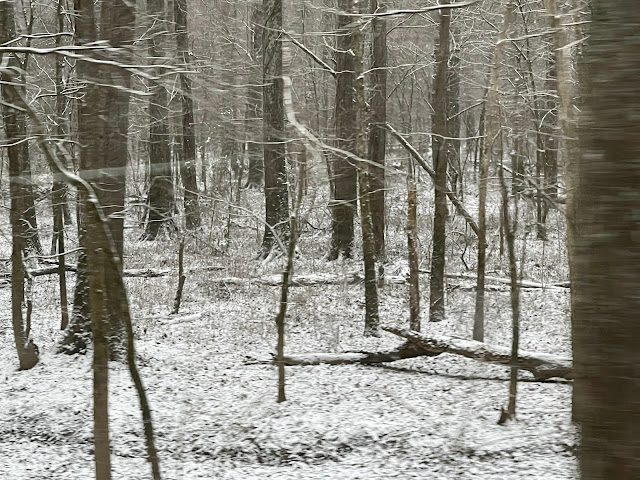
Our first sign of the impending doom: Snow around the Cracker Barrel at the Alabama 36 exit on I65 North. 


The road ahead--little did we know....


Fields were starting to get a nice dusting....


Since we were travelling the day after Christmas, signs of the holiday decorated several houses along the route. 


So far so good....


This ghost from Halloween hung around until Christmas.


Another field and a prominent tree...


This house burned sometime in the last year or so.


Driving by woods on a snowy evening....


I have written about Cotaco here. 


This church is featured in the Valhermoso Springs post


A sign of things to come...


I've written about this abandoned grocery, gas station and cafe here


Even abandoned cars had some snow.


We finally arrived home at mom's house on Green Mountain Road. Police had closed the road just above her house, and many cars were parked in the area. A few remained overnight. 


Son Amos took this photo and the two below when he went for a walk after we arrived at mom's. I wrote about this cemetery in 2014; it seems to have had better care since then. 


Enough snow fell to write in at least! You can't see the "Happy" preceding the year. 


Friday, December 30, 2022

Lacey's Spring Cemetery

On a recent trip to see mom in Huntsville my brother Richard pointed out this small cemetery to me; it's located on Bartee Road, a very short street that connects US 231 and Alabama 36 where those two intersect. See the maps below to understand what I mean.

I've written before about the Wavaho Company and its gas station at that intersection. I've also written a couple of posts about other landmarks in Lacey's Spring here and here. An extensive history of the town and it's historical marker is available here.

That history involves the three Lacy brothers, John, Hopkins and Theophilus, who were born in Virginia and ended up in north Alabama in the early 1820s after periods in North Carolina and Tennessee. The town was named after them; an "e" was added to its name later through a postal department error. All three and other family members are buried in this location. John Lacy is supposed to have served in the North Carolina militia during the Revolutionary War. 

The cemetery is very close to the town's United Methodist Church which faces Alabama 36. As seen in one of the photos below, the location is named Lacey's Springs Cemetery, but it's also known as Bartee Cemetery. William T. Bartee was Postmaster at Lacey's Spring from 1887 until 1904; he was also a representative to the state legislature 1892-93. He is buried here, along with his second wife and daughter. They are not included in this inventory, but the Lacy brothers and many others appear. 

On another recent trip I quickly took the photographs below. Perhaps soon I can stop again and get out of the car to wander. Google Maps also reveals locations for several other cemeteries in the area. 


Even this small cemetery has its Woodman of the World monument.


John Lacy has both an old and new monument. 


The cemetery is still in active use, so there are very old and very new monuments.


Source for both maps: Google Maps