Friday, October 28, 2016

South City Theatre in Pelham

On October 9 Dianne, myself and a friend of ours attended a matinee performance of George Batson's play "Design for Murder" at South City Theatre in Pelham. Back in the winter Dianne and I had seen their production of Agatha Christie's "The Mousetrap", and we thoroughly enjoyed both of these performances.

South City Theatre has mounted over 150 adult and children's productions since its founding around 2000. In 2015 the non-profit company moved to its current location in Pelham. The venue is small but intimate, and it's nice to have live theater so close to home.

Below are some photos and more information related to the most recent production we saw and to the play itself. 


These two photos show the set for "Design for Murder". 


"Design for Murder" is licensed by the Samuel French Company. Below are a couple of quotes from reviews of earlier productions and the plot summary on the company's web site. Written in 1960, the play is set in the 1930's. Batson seems to have written a number of comedies and light-hearted mystery plays over several decades. Tallulah Bankhead also toured in Batson's final production, "House on the Rocks", according to his obituary in the New York Times


"A swell chiller. A couple of juicy killings and the identify of the culprit well concealed." - New York Mirror 


"A fast moving, highly tensed whodunit." - London Stage


"Tallulah Bankhead toured in this exciting play. The story concerns Celia Granger, her son David and her efforts to maintain the traditions attached to her family and home, a magnificent old mansion on the Hudson River. Suddenly a young maid is killed and Celia finds herself living in a violent present. The detective on the case, a rugged self made man, is revealed to have admired Celia and brings a touch of romance to her life. When the chauffeur who had stumbled upon information linking David and the slain girl is also brutally murdered suspicion falls on every member of the cast. The climax finds Celia alone in the house and the murderer ready to strike again. Comedy is supplied by two women friends who also figure among the suspects."


    Tuesday, October 25, 2016

    Movies with Alabama Connections (9): Right of the Strongest

    In the early part of the 20th century Frances Nimmo Greene [1867-1937] was a popular Alabama author; today she is probably unknown to all but scholars of the state's literature. From 1901 until 1920 she wrote successful books for both adults and children. Born in Tuscaloosa, Greene was also a teacher, library worker, newspaper columnist and later in life an author of plays. She died in Birmingham.

    In April 1924 Zenith Pictures and David Selznik's Distributing Corporation released the film version of one of her popular novels, The Right of the Strongest. Greene's Encyclopedia of Alabama entry by Dorothy Grimes describes the book's plot: "The story involves a woman caught between two men, a progressive developer and a man of the hill country, and anticipates modern environmental and social issues concerning the use of natural resources." 

    Helen Ferguson played heroine Mary Elizabeth Dale. Actors E.K. Lincoln and George Siegmann starred as John Marshall and Trav Williams. The film was directed by Edgar Davis. All four individuals were veterans of silent film. One of the ads below describes the film as "A tense, enthralling, fast-action melodrama which presents a colorful portrayal of life among the 'hill-billies' and feudists of the Alabama mountains." Another claims that the movie is "one of the greatest melodramas ever filmed."

    The book is available via the Internet Archive. I have been unable to determine the length of the film or whether a copy has survived. Further research might also determine theaters in Alabama where the film played and reactions of state citizens. 


    This double-page color advertisement appeared in Film Daily 6 July 1924


    E.K. Lincoln in 1919 

    Source: Wikipedia 


    Helen Ferguson [1901-1988]

    Source: Wikipedia 


    George Siegmann [1882-1928]

    Source: Wikipedia


    Friday, October 21, 2016

    Birmingham Photo of the Day (52): Railroad Reservation

    One of the big events in recent Birmingham history was the opening of Railroad Park in downtown in September 2010. The park was created from the Railroad Reservation, an expanse in the middle of the city's street grid that was 1000 feet wide and almost a mile in length. The reservation had been announced by the Elyton Land Company in January 1872 during Birmingham's early development. The train tracks are still active today, but the site is now also the scene of everything from concerts to yoga classes. This development has been important to Birmingham's ongoing transformation.

    The undated photograph below was taken by O.V. Hunt, and shows the Railroad Reservation looking west across the Southern Railroad freight houses. In the near view is the 21st Street or "Rainbow" viaduct, opened in May 1919. The bridge is dedicated to members of the 167th Infantry Regiment, a part of the famed World War I "Rainbow" division. The large building in the distance was the Crane Company's plumbing supply house.  

    The vehicles in the photo would seem to indicate the picture was taken before 1940. 


    Source: Birmingham Public Library Digital Collections


    Tuesday, October 18, 2016

    A Visit to the Dauphin Island Area (4)

    This post is the final one in a four-part series about our recent trip to Dauphin Island. Our hosts were my sister-in-law Lucy and brother Richard. Son Amos joined us from Baton Rouge. Some comments are below.

    Part one is here; part two is here; and part three is here


    The area's history of hurricanes is visible in all kinds of ways.


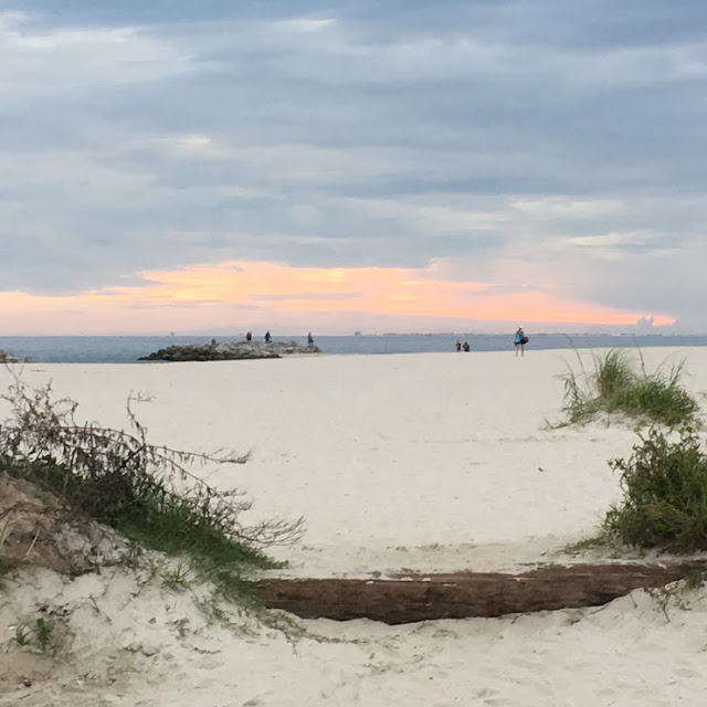
    Gulf side beaches are one of the glorious sights on the island.


    One of the cannons at Fort Gaines, established on the island in 1821. The fort played a prominent role in the Battle of Mobile Bay in August 1864. 


    Sunset from Fort Gaines can be another natural wonder of the island.


    Also visible from Dauphin Island are some of the oil rigs in the Gulf. 


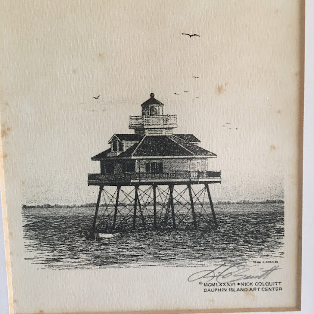
    Lucy & Richard's house has this drawing that features the Middle Bay Lighthouse. Activated in 1885, the lighthouse was taken out of service in 1967 but still stands in the Bay. The structure is one of five lighthouses that have operated in Alabama. 


    A frequent pleasure of our trips to the Mobile area is a stop for lunch at this establishment at one of the Greenville interstate exits.


    Friday, October 14, 2016

    A Visit to the Dauphin Island Area (3)

    This post is the third of four describing a recent trip Dianne and I made to Dauphin Island to stay with my brother Richard and his wife Lucy. Son Amos joined us from Baton Rouge. Comments are below.

    The first post can be found here, the second one here and part four here.


    Friday's sunset on the Gulf side of the island was worth a viewing.


    On Friday night after Amos arrived from Baton Rouge we headed out in search of some adult beverages. Dianne took this photo.


    On Saturday Dianne, Amos and I had a nice lunch at the Pirates Bar & Grill at the Isle Dauphin Club


    Built in the late 1950's, the club is one of Dauphin Island's architectural standouts. Son Amos, the urban planner, noted right away that it looked like an example of "googie" architecture. That style of "space age" or "atomic age" building began in southern California in the late 1940's and lasted into the mid-1960's. Many motels, gas stations, coffee shops and other structures were influenced by the style, which was named after a west Hollywood coffee shop called Googies.  


    This postcard shows the club in the 1960's.
    Source: Troy University Library


    There's a very nice view of the water from the club. 


    Here's a friend who spent most of the weekend hanging around the house with us. 


    The Indian Shell Mound is the oldest sign of man on the island and has survived all the hurricanes. The area is now a small park with a trail, benches and some photographic trees. 


    Tuesday, October 11, 2016

    A Visit to the Dauphin Island Area (2)

    This post is the second of four related to a visit to Dauphin Island Dianne and I made recently. Our son Amos also joined us from Baton Rouge. One of the places we saw with our hosts, my brother Richard and his wife Lucy, was the small community of Coden

    This unincorporated fishing village is located on Bayou Coden, and the name is an English version of the French Coq d'Inde. Like nearby Bayou la Batre, Coden was a resort town in the late 19th century, but the 1906 hurricane ended much of that business. I've included comments below my photos and a few historical photos at the end of this post.  

    The first post in the series can be found here, part three here and part four here.


    Coden has a community center and a post office, both good signs of survival in a small town. 


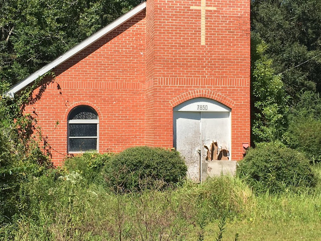
    Always sad to see abandoned structures, but churches seem especially so. The sign says "Coleman Chapel A.M.E. Zion Church, Pastor B. Sanders". I spent some time searching on Google and could find nothing about this church. 


    Abandoned boats are a common sight in this part of Alabama. 


    Now here are a couple of interesting sights down an unpaved road near Coden. We were looking for Zirlotts Seafood operation, a legendary family business in the area. We found it, and even though we arrived after closing time that afternoon, family members came out of their house to open up and let us purchase some of the goods. 

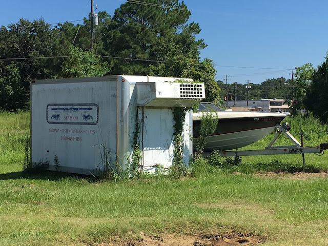
    As we left, we decided to take a closer look at these two items which we had spotted earlier. The trailer above is behind the fence of a small cattle farm. The structure below mystified all of us, but someone else has suggested to me that it looks like a hunting blind. 


    A house in Coden with a facade covered with oyster shells, about 1905.

    Source: Alabama Mosaic


    A grocery store in Coden before 1905

    Source: Alabama Mosaic 


    Rolston Hotel in Coden, ca. 1916

    Source: Alabama Mosaic


    Friday, October 7, 2016

    A Visit to the Dauphin Island Area (1)

    OK, just what is this "Dauphin" thing, anyway? 

    From 1350 to 1791 and 1824 to 1830 this term described the heir apparent to the throne of France. The family's coat of arms featured a dolphin, which in French is "dauphin". That's a very simplified version of the French royal history; you can read a much more detailed version on Wikipedia

    Over the years Dauphin Island has been occupied by Native American, Spanish, French, British, American and Confederate populations. The island has a long, fascinating history that began more than 500 years ago with frequent Native American visits. Spanish mapped the island around 1519 and named it Isla de San Feliz. The French, who arrived in the late 17th century, called it Ile du Massacre since they found dozens of skeletons there. U.S. forces seized the island from Spain in 1813, and the British held it briefly in 1815. Dauphin Island became part of the Alabama Territory upon its creation in 1817.

    Today the island is mostly a vacation haven and target for hurricanes. Since 1979 Frederick, Elena, Danny, Georges, Ivan and Katrina have all done serious damage on the island. 

    Sometime years ago when the kids were young, and we were visiting Gulf Shores, Dianne, the kids and I took the ferry from Fort Morgan and spent some time on the island. Recently my brother Richard and his wife Lucy have bought an interest in a house on the island and invited Dianne and I to come visit. Our son Amos joined us from Baton Rouge. This post and three that follow cover some of the sights from that long weekend. 

    I've included two historical photos and a map at the end.

    Part two of this series is here, part three here and part four here.


    Here's the first sunset from the deck of their house on Lafitte Bay. 


    Here's the view bright and early next morning. 


    We had an excellent lunch at this popular place back on the mainland. The restaurant is located in Irvington just past Bayou La Batre.  


    Today Bayou La Batre is primarily a fishing town. Its origins go back to a 1786 land grant from the Spanish to a French settler. In 1811 the town became part of the United States, and by the 1830's had its own hotel. Because of its location on the water, tourism developed after the Civil War. 


    A hurricane in 1906 devastated the town and its tourism. By the 1920's the seafood industry and later shipbuilding became the economic mainstays. In the late 1970's immigrants from Vietnam, Cambodia and Laos added significantly to the local cultural mix. An episode of the Alabama Public Television program Journey Proud explores these changes over the recent decades.


    Abandoned structures and boats are frequent sights in the Bayou La Batre area. 


    Smee General Merchandise in Bayou La Batre ca. 1900

    Source: Alabama Mosaic


    Fishing boats and oyster cannery in Bayou La Batre in the 1930's


    Source: Alabama Mosaic

    Fire insurance map of Bayou La Batre, 1955

    Source: Alabama Mosaic